News and Testimonials
8 of the best road trips in Patagonia: explore remote and iconic landscapes by car
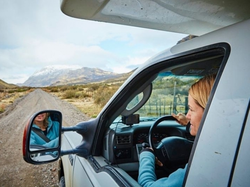
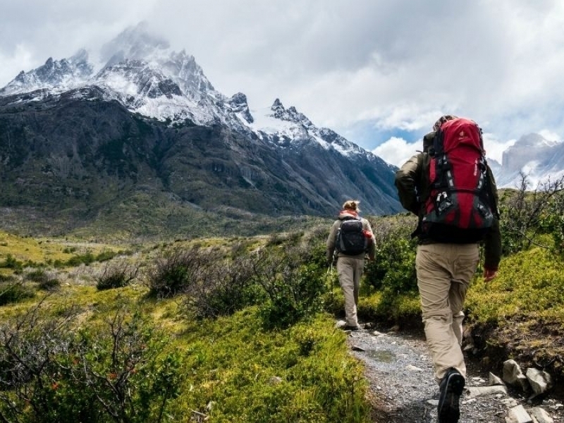
Given the region’s vastness and the remoteness of many of its most scenic roads and destinations, road-tripping is the best way to explore Patagonia, particularly if you want to journey off the beaten track.
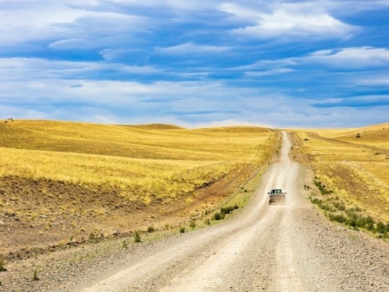
While the main roads between towns are mostly paved, and even Chile’s Carretera Austral and Argentina’s Ruta 40 are no longer more pothole than road, you may still have to contend with challenging driving conditions: occasional landslides, muddy sections or a bumpy "washboard".
Things to know before you go
While a 4WD is not essential, a vehicle with high clearance is preferable – and essential on minor side routes. The best time to drive around is between October and April, as during the southern winter, some side routes may be closed by snow. Bear in mind that some routes cross the border between Chile and Argentina, so you’ll need special permission to cross borders from your rental company. Also, one-way drop-off fees are hefty, so plan your journey carefully. Here are nine of the best road trips in Patagonia (and Tierra del Fuego), ranging from three hours to a couple of weeks.
Carretera Austral is Chile's most iconic drive
Start: Puerto Montt; end: Villa O’Higgins; distance: 760 miles (1223km); allow 10 days
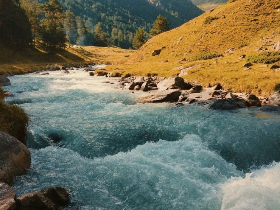
The big one. The so-called "Southern Highway" is Chile’s most iconic drive that snakes south from Chile’s Lake District across a landscape of dense forest, snow-peaked mountains, volcanoes, glacial rivers, and misty fjords. A Pinochet-commissioned project in the 1970s, the road was supposed to tame the wilderness and help settle the isolated Aysén region. The southern section is still not paved, which makes travel more challenging. Be prepared for inclement weather and occasional delays (landslides, having to wait for car ferries, etc).
Start in Puerto Montt, the Lake District’s port city, take the first of four ferries, then pass through the salmon-farming town of Hornopirén, before taking two interconnecting ferries through the fjords, with a strip of land in between, to reach the southern half of Parque Nacional Pumalín Douglas Tompkins – a vast area of native forest, gifted to the state by the Tompkins philanthropists. Just south is Chaitén, half buried by the volcanic eruption of 2008 but since recovered, followed by the Villa Santa Lucía crossroads town; from here, you can detour to Futaleufú – Chile’s whitewater rafting capital. Passing through dense woodland, you reach the market town of La Junta, before arriving at picturesque, fjordside Puyuhuapi, famous for its hot springs. The road skirts the fjord and passes high-end fly-fishing lodges before the highest section of the Carretera Austral takes you over Queulat Pass, with mist-shrouded mountains looming ahead. Stretch your legs in Parque Nacional Queulat before following the hilly ribbon of road to Coyhaique, the largest town halfway along the Carretera Austral.
The southern half of the journey is even more remote, sweeping through the pioneer town of Villa Cerro Castillo, past the glacial Lago General Carrera, and through tiny Puerto Río Tranquilo – the jumping-off point for glacier hikes and boat trips to the Capilla de Mármol. Farther south, the ranching town of Cochrane is a good overnighter, and a convenient base for visiting Parque Nacional Patagonia – another Tompkins conservation project – before detouring off the main route to Caleta Tortel – a unique village with cypress boardwalks instead of streets. A final ferry crossing from Puerto Yungay, and narrow hairpin bends of a particularly precipitous stretch of road, with glimpses of forest-clad mountains and raging glacial river below, bring you to Villa O’Higgins, a small pioneer settlement at the end of the road. Then you can either retrace your steps or take a weekly ferry from Puerto Yungay to Puerto Natales, and adventure further in the south.
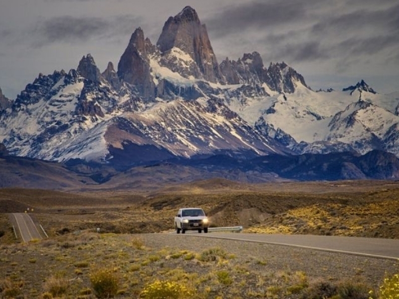
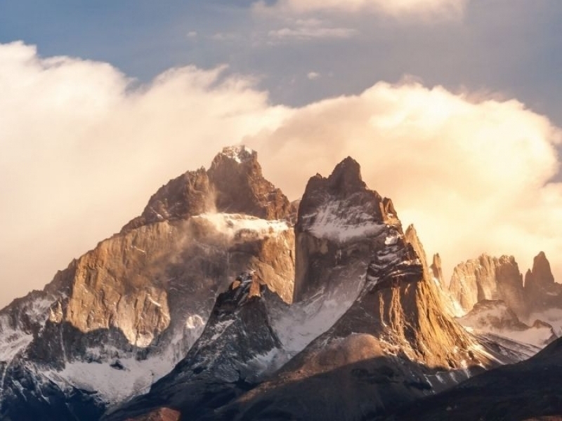
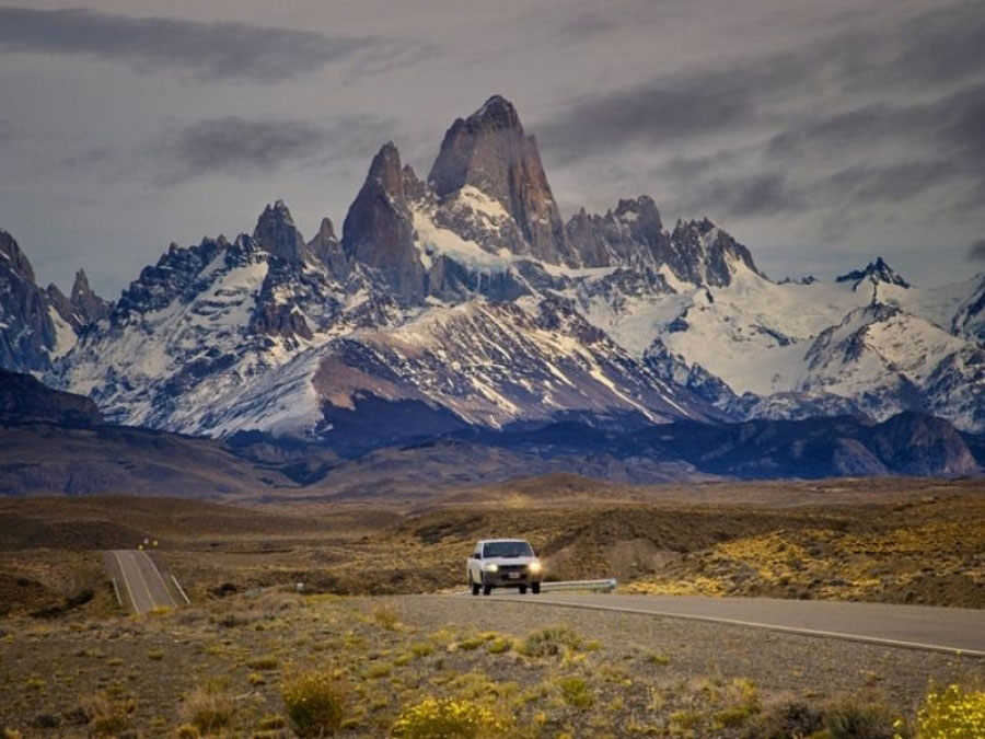
Ruta 40 is a legendary drive through Patagonia's iconic grassland
Start: El Calafate; end: Bariloche; distance: 1017 miles (1637km); allow two weeks
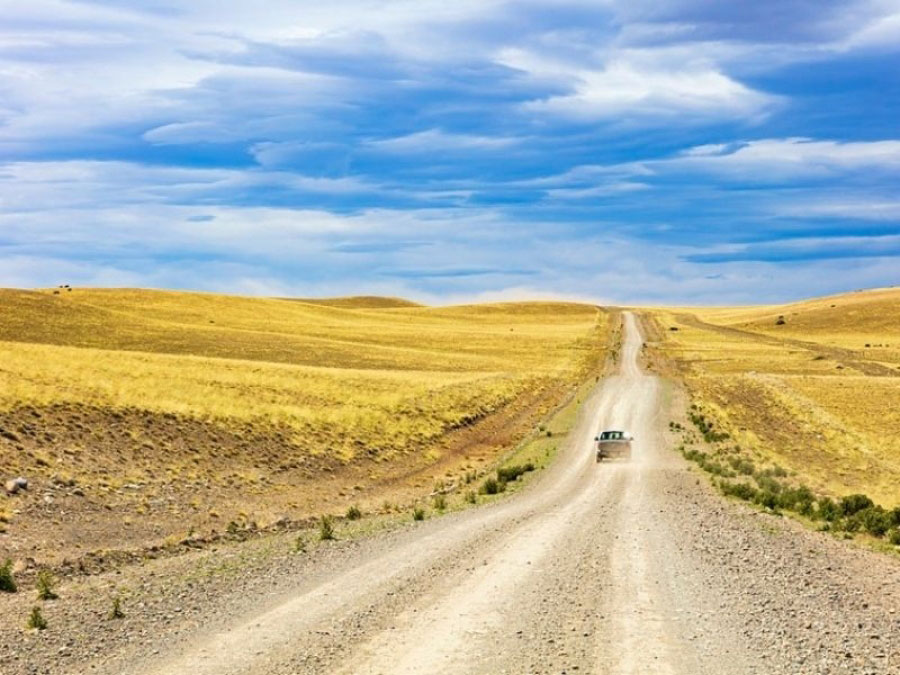
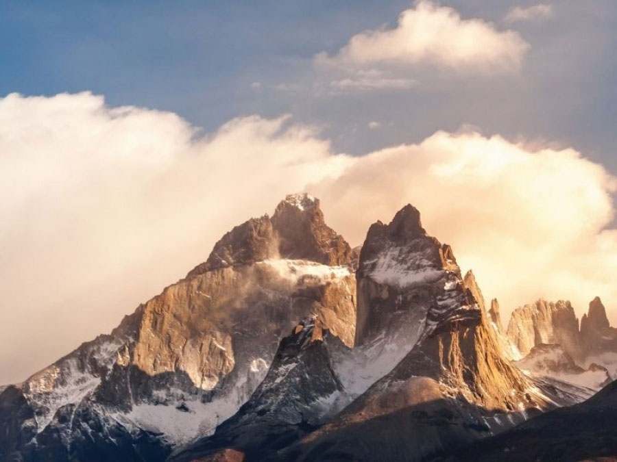
This is the other big one. Even bigger, in fact. Known fondly by Argentinians as La Cuarenta (The Forty), Ruta 40 has the same legendary status in Argentina as Route 66 in the States. Some 3246 miles (5224km) long, it stretches the entire length of Argentina, from Cabo Vírgenes in southeast Patagonia to the border with Bolivia. Even if you don’t drive the entire length you can experience the most remote and arguably most scenic section that’s particularly associated with Ruta 40’s rugged mystique, traversing the vast pampas (steppe) that stretch as far as the eye can see. But it’s not just endless grasslands, where you’ll spot occasional flocks of sheep and swift-footed ñandú (rhea); you’ll also never be far from the bristling of the Andes mountain range that marks the border between Chile and Argentina. Take your time (and not just because the southern section of Ruta 40 is still not completely paved).
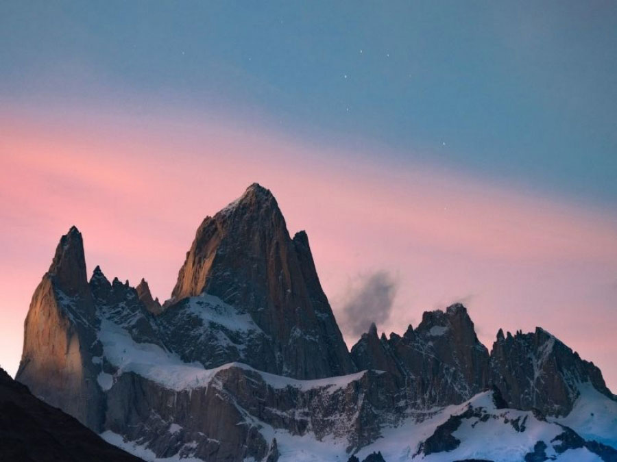
Start in El Calafate – the jumping-off point for Argentina’s most accessible and spectacular glaciers, such as Perito Moreno, and head north, past the shores of the impossibly blue Lago Argentino and Lago Viedma. Detour alongside the second lake towards the Fitz Roy mountain range above the tiny trekking capital of El Chaltén before resuming your journey north. Places to stay are few and far between as you pass through small and dreary service towns – Gobernador Gregores, Bajo Caracoles, Perito Moreno (not to be confused with the glacier) and isolated estancias. Before reaching the last town, detour through a scenic valley to the Cueva de Las Manos – some of Argentina’s most spectacular cave art. A day’s drive beyond Perito Moreno, linger in the outdoorsy hub of Esquel and go hiking and kayaking, before finishing up in Bariloche (technically in the Lake District rather than Patagonia) with its picture-perfect setting on Lago Nahuel Huapi, surrounded by soaring mountain peaks.
Explore the region's Welsh culture on Ruta 25
Start: Esquel; end: Puerto Madryn; distance: 417 miles (671km); allow 3–4 days
This tour begins at unprepossessing little Esquel – a hub for hikers bound for the nearby Parque Nacional Los Alerces and kayakers seeking watery adventure on Río Percey and Laguna Terraplén – in the foothills of Argentina’s western Chubut province. It ends in Puerto Madryn, the jumping-off point for the Valdés Peninsula, renowned for its year-round marine life and seasonal whale watching. En route, you’ll stop at the small towns of Dolavon and Gaiman, the majority of whose residents claim Welsh ancestry dating back to the 1860s, when intrepid Welsh immigrants came to Argentina to protect Welsh culture and language that they considered to be under threat in their native Wales. Before you hit Route 25, it’s well worth detouring west from Esquel to Trevelin, another village with Welsh roots – 16 miles (26km) each way. All three villages have preserved the tradition of Welsh high tea, with tea houses offering cream tea with an assortment of cakes; Gaiman’s residents are particularly proud of Princess Diana’s tea-related visit in 1995. Welsh is still widely spoken (with Patagonian inflections) and has enjoyed a recent revival. Route 25 will take you across great swathes of pampas and through a particularly spectacular valley – Valle de los Altares – with red rock formations reminiscent of Utah or Arizona.
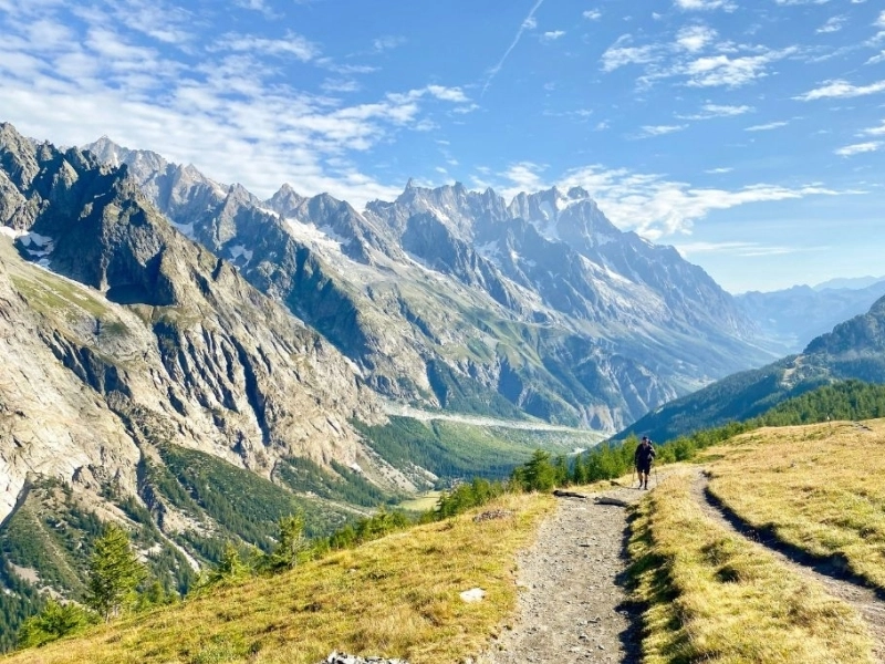
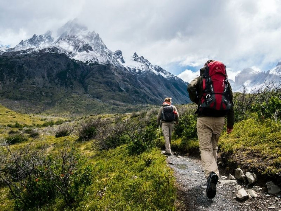
Wonder at the natural beauty and wildlife on the Valle Chacabuco drive
Start/end: Miradór Río Baker; distance: 91 miles (146km); allow 1–3 days
Near a scenic viewpoint overlooking Río Baker, some 11 miles (18km) north of the ranching town of Cochrane, the X-83 passes through Parque Nacional Patagonia and runs all the way to the border with Argentina. Part of the immense rewilding initiative by philanthropists Doug and Kris Tompkins, a formerly overgrazed sheep ranch, Estancia Chacabuco, was transformed into a national park of extraordinary natural beauty, once again populated by guanacos, flamingos, foxes, endangered huemul deer and the odd puma. You’ll want to take it slow, not just because it’s a narrow, bumpy gravel road with some blind corners, but also because you’ll want to absorb views of the scrubland covered hills, thickets of cypresses, the snow-peaked Jeinimeni mountain range in the distance, and the startling blue of meltwater lagoons and the Río Áviles. Wildlife sightings are common (watch out for flamingos by the roadside lagoons) and it’s worth spending at least a couple of days here, hiking the trails from the several trailheads that are some distance apart. If you have a sturdy vehicle, you can cross Paso Roballos into Argentina and connect to Ruta 40.
Follow the Valle de Río Palena to a bay full of marine life
Start: La Junta; end: Raúl Marin Balmaceda; distance: 47 miles (75km); allow 3–4 hours
Linking the little service town of La Junta, en route between Puyuhuapi and the Futaleufú Valley on the Carretera Austral, with white-sand beaches and a bay teeming with marine life, this narrow gravel road follows the perambulations of the twisting teal ribbon of Río Palena through stretches of open countryside and thickets of southern beech forest. Pull over at the rustic Termas del Sauce, 10 miles (17km) into the drive for a soak in the natural hot springs. Shortly before you find yourself driving one of the wide sandy streets of Raúl Marin Balmaceda – the Aysén region’s oldest village, founded in 1889 – you have to take a car ferry across the river. Until this new road was built, the village was among the most isolated in Chile. Local guides can take you dolphin- and sea bird-spotting by boat, or you can look for seals and cormorants while paddling a kayak. If you don’t want to retrace your steps, take advantage of one of the two weekly car ferries – one heading south to Puerto Chacabuco (for Coyhaique), and the other destined for Quellón, on the southern tip of the island of Chiloé.
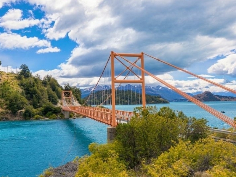
Lago General Carrera Route is a superb scenic side trip off the Carretera Austral
Start: Cruce el Maitén; end: Chile Chico; distance: 71 miles (115km); allow 3 hours
If you’re already driving the southern half of the Carretera Austral, this is a wonderfully scenic side trip from the fork in the road, and along the southern shore of the vast Lago General Carrera – an icy lake whose waters turn from sun-speckled turquoise to a deep sapphire, depending on the weather. Some 8 miles (13km) in, you breeze through Puerto Guadál – a sleepy village with unique accommodations nearby that make a good base for watery adventures – before the road becomes progressively narrower and more precipitous as it climbs steeply above the lake, winding its way around blind corners. Jaw-droppingly beautiful lake vistas open up around every blind corner, but be careful: there are no guardrails and in places, the road is too narrow for two vehicles to pass each other. It’s worth lingering a few days in Chile Chico, an agricultural town with a sunny microclimate; from November to January, gorge yourself on local cherries. From here, you can explore the ancient rock art and arid landscapes of Reserva Nacional Lago Jeinimeni, or press on across the border to Argentina and its iconic Ruta 40. Alternatively – for a shortcut back to the Carretera Austral, take the car ferry across the lake to Puerto Ibañez.
The End of the World is a wonderful one-day drive
Start: Punta Arenas; end: Ushuaia; distance: 388 miles (624km); allow 10–12 hours
This spectacular drive, done in a single day, takes in the navy-blue, wind-whipped Magellan Strait and the equally windswept wide open spaces of Chilean Patagonia before crossing the strait and traversing the vast island of Tierra del Fuego and finally arriving at Argentina’s southernmost city at the end of the world. The first part of the route skirts the strait, leaving behind the graceful stone mansions of Chile’s historic port of Punta Arenas. You enter a scrubland-covered landscape, dotted with occasional estancias before crossing the narrowest part of the strait by regular car ferry (watch out for black-and-white Peale’s dolphins!) to Tierra del Fuego (named after the smoke from the campfires of its indigenous inhabitants). A partially-paved gravel road takes you across an austere landscape of bare hills and yet more scrubland before breezing through the tiny mining town of Cerro Sombrero and eventually crossing the border to the Argentinean half of the island. You get expansive views of the Atlantic before passing through the towns of Rio Grande and Tolhuín before skirting the long narrow glacial lake – Lago Fagnano. On the final approach to Ushuaia, the landscape becomes far more dramatic and mountainous, and you’re finally greeted with the sight of Ushuaia, set against the backdrop of the snow-tipped peaks of the Cordillera Darwin, its steep streets resembling an amphitheater above the deep blue of the Beagle Channel. From here, there’s nowhere to go but back – unless you’re taking a cruise to Antarctica.
Drive the winding Valle Exploradores to an ice field
Start/end: Puerto Río Tranquilo; distance: 107 miles (172km); allow 4–6 hours
Another great side trip from the southern half of the Carretera Austral, this relatively new road has made Laguna San Rafael much more accessible. Until it was built a few years back, the only way to access the aquamarine lagoon, filled with house-sized chunks of ice, and to sail past the face of the ever-shrinking, 30,000-year-old San Valentín glacier, was by pricey catamaran trip from Puerto Chacabuco, near Coyhaique. This narrow, winding, gravel road takes you through the aptly-named Valley of Explorers all the way up to a boat landing, where you complete the rest of the journey to the glacier by inflatable Zodiac boat with the help of Puerto Río Tranquilo operators. But even if you don’t visit the San Valentín glacier, the drive itself is spectacular: it follows the bends of Río Exploradores through temperate rainforest of southern beech, thickets of ferns and nalca (giant wild rhubarb), passing waterfalls and ice melt lakes. It’s well worth stopping at Km 52 and paying a small entry fee to climb up to the Miradór Glaciar Exploradores for all-encompassing views of the northernmost ice tongue protruding from the Northern Patagonian Ice Field. To get up close to the glacier with crampons and an ice pick, make arrangements with El Puesto Expediciones.
Source: https://www.lonelyplanet.com/articles/best-road-trips-in-patagonia
Gallery
Other News and Testimonials